Straddling the provinces of Segovia and Madrid, Peñalara Natural Park is a favourite destination for the people of Madrid and Segovia in order to escape the hustle and bustle of the city. At an altitude of between 1,640 and 2,428 metres, it lies within the Sierra de Guadarrama National Park, which means it is a highly protected area. Every year it is visited by more than 130,000 people.
Spanning 768 hectares, its official name has actually been the Parque Natural de la Cumbre, Circo y Lagunas de Peñalara since 15 June 1990. It is home to no less than the highest peak in the Sierra de Guadarrama, known as the Pico de Peñalara, the mountain range’s main focal point not just for its altitude but also because it is situated at the confluence of two large and iconic valleys: the Lozoya Valley and the Valsaín Valley.
Pico de Peñalara, a sacred mountain
It is known that the Pico de Peñalara was a sacred mountain for Arevaci—Celtic people who settled in the area before the arrival of the Romans. The mountain is a popular destination for hikers who climb up to its summit as it doesn’t present too much difficulty. Precisely the reason why it is said to be the great training ground of Madrid’s mountain climbing beginners. In winter it is also a popular place for ice climbing.
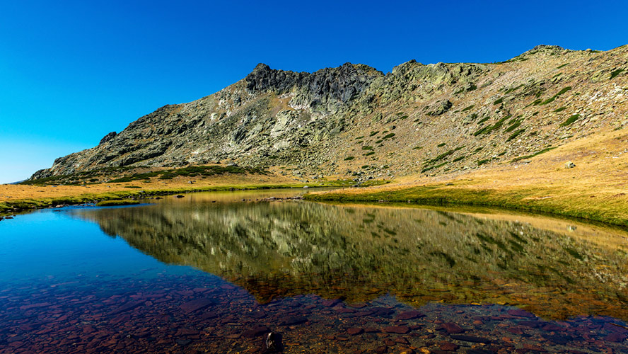
The slopes of the mountain are home to numerous water springs, which give rise to 20 glacier lagoons, among which stands out Laguna Grande (Big Lagoon), also known as Peñalara Lagoon, in addition to Los Pájaros, Los Claveles and Chica lagoons, which are frozen over in winter. All are very close to one another and share spectacular landscapes and views of the incredible surrounding beauty. The park boasts highly recommended and attractive route through the lagoons.
The natural park is full of plenty other peaks, albeit somewhat lower than the Pico de Peñalara but nevertheless of considerable height. This is certainly the case for the Risco de los Claveles, which stands at an altitude of 2,388 metres, or the Risco de los Pájaros, at 2,334 metres. The park is also home to three small cirques and two moraines. One of the most interesting places is the Peñalara cirque, also formed by glacial erosion, which is situated between the summits of Peñalara and Hermana Mayor.
Flora and fauna in Peñalara Park
The flora and fauna of Peñalara Park is typical of high mountainous areas, which means an assortment of species that are able to withstand the tough weather conditions. In terms of flora, on a climb to the top of Peñalara you’ll find Scots pines, blueberry plants, heathers, junipers, fern undergrowth, wild flowers and up to 200 species of lichens. As far as fauna goes, the park is home to birds such as the black vulture, the Spanish imperial eagle, the common rock thrush and the bluethroat; as well as small mammals (squirrels, rabbits and badgers) and the ten species of amphibians that inhabit its lagoons, of which seven are in danger of extinction. In fact, it is one of the European mountain areas with the greatest amphibian biodiversity.
The most famous hiking route
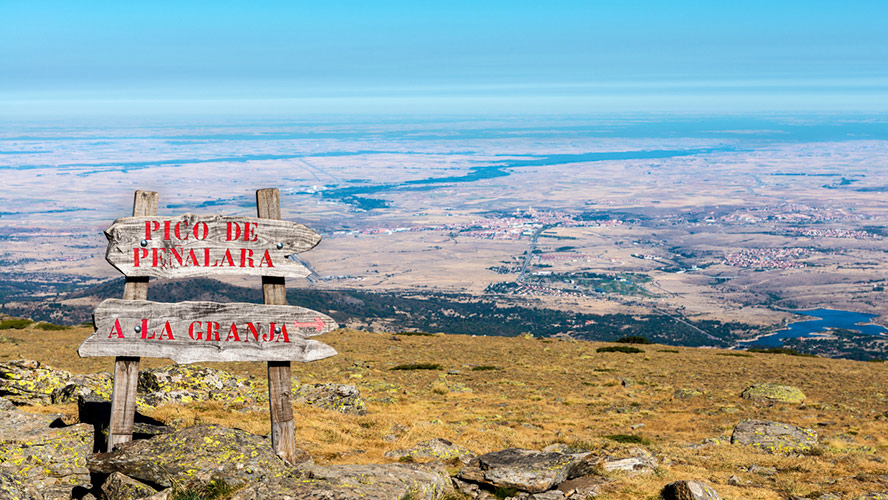
The natural park boasts numerous safe, plotted hiking paths, which cross the natural park from one side to the other. One of the most famous hiking routes starts at the Puerto de Cotos mountain pass and ends at the Peñalara Lagoon. The low-difficulty route spans some four kilometres and takes about two hours and a half to complete. On the way back you can take the same trail or a path that goes around the Zabala refuge and down the trails of the old Valcotos ski station, which was dismantled in 1999 to protect the park form external damage.
In short, Peñalara Natural Park is a perfect place to escape from the hustle and bustle of the city, enjoying the beauty of its spectacular landscape and enjoying an array of hiking and climbing options.